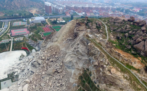
Abstract: Human eyes and subjective feelings, for the environment of small changes, in fact, is relatively slow, so it is normal to not notice, but the surface of the small changes in the situation can not not be examined, so the use of specialized GNSS surface displacement monitor is a very necessary thing.
Changes in the surface condition usually mean that the local geological condition is undergoing subtle changes. If you do not pay attention to the subtle changes, they may accumulate into a large number, and eventually lead to terrible damage. Monitoring changes in the terrain must start small, even the slightest change should be noted and acted upon in a timely manner.
But many people in life for terrain changes in the situation, the lack of full awareness, not to mention people on the surface of the problem of observation of the scope of the problem is often relatively broad, those changes are limited to centimeter-level changes in the terrain, in fact, is not easy to be observed, in the long run, many of its own significant value of the terrain changes, it is ignored, which is very scary. The human eye and subjective feelings, for the environment of small changes, in fact, is relatively slow, so it is normal to not notice, but the surface of the small changes in the situation can not not be examined, so the use of specialized GNSS surface displacement monitor is a very necessary thing.

The GNSS surface displacement monitor uses RTK measurement technology and GNSS satellite positioning technology to accurately measure the relative displacement changes of the more stable points around the landslide and the landslide monitoring points, so as to judge the surface conditions.
RTK measurement technology is a new satellite positioning measurement method, also known as real-time differential positioning technology, is a kind of technology that can instantly obtain centimeter-level accurate positioning data in the field, and its appearance can greatly improve the efficiency of the staff and working machinery in the field environment.
GNSS surface displacement monitor consists of three parts: GPS receiver at the reference station, data chain and GPS receiver at the mobile station. The receiver at the reference station serves as a reference station to make continuous observation of the satellite, and sends its observation data and related information to the mobile station instantly through the radio transmission equipment, and the GPS receiver at the mobile station, at the same time of accepting the GPS signals, receives the data transmitted from the reference station through the wireless reception equipment, and then receives the data transmitted from the reference station according to the relative positioning. At the same time, the GPS receiver of the mobile station receives the GPS signal, and receives the data transmitted from the reference station through the wireless receiving equipment, and then instantly solves the three-dimensional coordinates of the mobile station according to the principle of relative positioning, which has a fairly high measurement accuracy.
Based on the self-developed BeiDou high-precision positioning innovative technology and spatio-temporal intelligence platform, Chance Location combines satellite positioning, intelligent Internet of Things, converged communication and other technologies, and selects cloud computing and artificial intelligence to create a new generation of safety monitoring system. It builds a solution with the ability of real-time detection, intelligent analysis, online monitoring, early warning and forecasting, human-technology joint defense, etc., realizing the leap from manual inspection to multi-dimensional online monitoring.
Junoda Technology mainly provides integrated antenna module, dual-frequency high-precision module, single-frequency high-precision module, Qianxun high-precision module, Zhongke micro-positioning module, U-BLOX positioning module, SICOM communication module, inertial navigation DR module, UW GNSS module, RTK differential module, 4G communication module and high-precision antenna, etc., and the products are sold well in Beijing, Shanghai, Shenzhen, Guangdong, Jiangsu, Zhejiang, Sichuan, Hunan and other parts of the country. The company's GNSS modules are widely used in drones, vehicle security monitoring and scheduling, automatic bus stops, DVR tachographs, in-car DVD navigation, GPS electronic dog, synchronized timing, high-altitude balloon monitoring, construction machinery, industrial automation and other applications.


