What does cors mean?
What is the meaning of Cors?
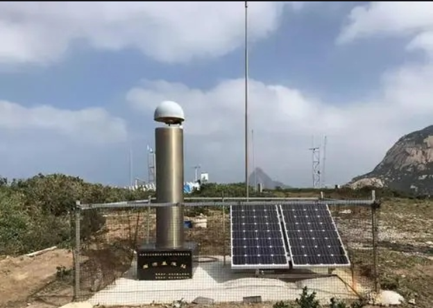
CORS (Continuously Operating Reference Stations) is a continuous operation (satellite positioning service) reference station established by utilizing multi-base station network RTK technology, which has become one of the hotspots for the development of urban GPS application.CORS system is a product of multi-faceted and in-depth crystallization of high technology, such as satellite positioning technology, computer network technology and digital communication technology. CORS system is a product of multi-directional and in-depth crystallization of satellite positioning technology, computer network technology and digital communication technology. CORS system consists of five parts: reference station network, data processing center, data transmission system, positioning and navigation data broadcasting system, and user application system, and each reference station is connected to the monitoring and analysis center through the data transmission system to form a dedicated network.
The development and application of satellite navigation and positioning technology has changed the traditional means of measurement technology, and the continuous operation reference station network constructed by the comprehensive application of GNSS technology, information technology, network technology, etc. has become the main part of the infrastructure of the national informatization construction.CORS contains one or a number of fixed, continuously operating GNSS continuous operation reference stations, using modern computer, data communication, The data transmission network composed of modern computer, data communication and Internet technologies, through the data center for data continuous real-time high-precision data processing, data product output and broadcasting, real-time to different types of users with different needs and at different levels to automatically provide different types of tested observation values, various corrections, status information, as well as other related navigation and positioning services of the integrated system.

The CORS system has revolutionized the traditional RTK measurement operation, and its main advantages are reflected in:
(1) Improved initialization time, expanded the range of effective work;
2) Adopting continuous base station, users can observe at any time, which is easy to use and improves the working efficiency;
3) Having a perfect data monitoring system, it can effectively eliminate systematic errors and weekly jumps and enhance the reliability of differential operation;
(4) Users do not need to set up reference stations, truly realizing stand-alone operation and reducing costs;
(5) The use of fixed and reliable data chain communication reduces noise interference;
(6) Providing remote INTERNET service, realizing the sharing of data;
7) Expanded the application scope of GPS in the dynamic field, which is more conducive to the precision navigation of vehicles, aircraft and ships;
8) provides a new opportunity for building a digital city.
CORS system is not only a dynamic and continuous positioning framework benchmark, but also an important urban infrastructure for rapid and high-precision acquisition of spatial data and geographic features, CORS can provide high-precision, high-reliability, real-time positioning information to a large number of users simultaneously in the urban area and realize the complete unification of urban mapping data, which will have a collection and application of modern urban basic GIS system will have a profound impact. It can not only establish and maintain the benchmark framework for urban mapping, but also provide high-precision spatial and temporal information in full-automatic, all-weather, and real-time, which will become the basis for regional planning, management and decision-making. The system can also provide differential positioning information, open up new applications for traffic navigation, and provide high-precision, high temporal and spatial resolution, all-weather, near-real-time, continuous sequences of changes in the amount of precipitable water vapor, from which a regional catastrophic weather monitoring and forecasting system can be gradually formed. In addition, CORS system can be used for communication system and electric power system in high precision time synchronization, and can be on the ground subsidence, geological hazards, earthquakes, etc. to provide monitoring and forecasting services, research to explore the process of spatial and temporal evolution of disasters.
However, in folk usage, CORS is also used to refer to the dual-frequency RTK service provided by the base station network, so you can distinguish it with the specific context of use.


