Satellite Positioning
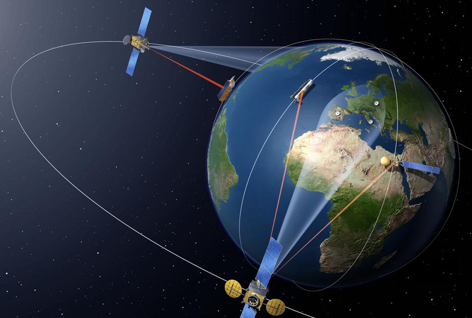
Satellite positioning system is a technology that uses satellites to accurately locate something, which has evolved from the initial low positioning accuracy, inability to locate in real time, and difficulty in providing timely navigation services, to today's high-precision GPS global positioning system, which realizes that four satellites can be observed at the same time at any moment and at any point on the earth in order to achieve navigation, positioning, timing and other functions.
Satellite positioning can be used to guide airplanes, ships, vehicles, and individuals to reach their destinations safely and accurately along selected routes and on time. Satellite positioning can also be applied to functions such as cell phone tracking.

Development and definition
Satellite positioning technology is a technology that utilizes artificial Earth satellites to carry out point location measurements. In the early days, artificial Earth satellites were only used as a kind of spatial observation target, and this kind of geometric observation of satellites could solve the problem of joint measurement and positioning of long-distance land and sea islands, which was difficult to be realized by conventional geodesy. However, this method is time-consuming and laborious, not only the positioning accuracy is low, but also the geocentric coordinates of the points cannot be measured.
The Meridian Satellite Navigation System (NNSS) developed by the U.S. in the late 1950s as the predecessor of GPS worked with a network of 5 to 6 satellites, circling the earth up to 13 times a day, but it could not give altitude information, and was not satisfactory in terms of positioning accuracy. However, the Meridian Instrument System enabled the R&D department to gain initial experience in satellite positioning and verified the feasibility of positioning by satellite systems, laying the groundwork for the development of the GPS system, which ushered in a new era of sea and air navigation and opened a new chapter in satellite geodesy.
As satellite positioning shows great superiority in navigation and meridian instrument system exists in the satellite less, can not be real-time positioning, the interval time and observation time is long, can not provide real-time positioning and navigation services, lower precision and other issues, the United States Navy, Army, Air Force, and civilian departments feel the urgent need for a new satellite navigation system.
To this end, the U.S. Naval Research Laboratory (NRL) proposed the name Tinmation with 12 to 18 satellites consisting of 10,000km altitude of the global positioning network plan, and in 67, 69 and 74 years each launched a test satellite in these satellites on a preliminary test of the atomic clock timing system, which is the basis of the GPS system for precise positioning. While the U.S. Air Force proposed 621-B to each cluster of four to five satellites to form three to four clusters of the plan, these satellites in addition to a synchronous orbit, the rest of the use of the period of 24h inclined orbit. The program propagates satellite ranging signals based on pseudo-random codes (PRNs), which can be detected even when the signal density is less than 1% of the ambient noise. The successful use of pseudo-random codes was an important basis for the success of the GPS system. Since the simultaneous development of two systems would have resulted in significant costs and both programs were designed to provide global positioning, in 1973 the U.S. Department of Defense merged the two into a single entity under the DOD-led Joint Program Office for Satellite Navigation and Positioning (JPO), which was also based at the Air Force Space Office in Los Angeles. The agency has a large membership, including representatives from the U.S. Army, Navy, Marine Corps, Department of Transportation, Defense Mapping Agency, NATO, and Australia.
The Global Positioning System (GPS) is a new generation of space-based satellite navigation and positioning system developed jointly by the U.S. Army, Navy and Air Force in the 1970s. Its main purpose is to provide real-time, all-weather and global navigation services for the three major areas of land, sea and air, and to be used for some military purposes such as intelligence collection, nuclear explosion monitoring and emergency communication, which is an important component of the United States' strategy of global domination. After more than 20 years of research and experimentation, and at a cost of 30 billion dollars, in March 1994, the global coverage rate of up to 98% of the 24 GPS satellite constellation was completed.
GPS is a globally-covered
satellite system consisting of 24 satellites. This system ensures that at any given moment, four satellites can be observed at the same time at any point on the earth to ensure that the satellites can collect the latitude, longitude and altitude of that observation point in order to realize navigation, positioning, timing and other functions. This technology can be used to guide airplanes, ships and vehicles, as well as individuals, safely and accurately along selected routes to reach their destinations on time.


