Successful Launch of Beidou Satellite Gives China a Completely Autonomous Global Positioning System
On this ordinary day, the eyes of our nation were fixed on Xichang, Sichuan Province, waiting for the launch of our country's last Beidou satellite.

Beidou Satellite Navigation System Logo
BeiDou Satellite Navigation System (BDS) is a global satellite navigation system developed by China, the third mature satellite navigation system after GPS and GLONASS, and a recognized supplier by the United Nations Satellite Navigation Committee.

Earth under the satellite
The BeiDou satellite navigation system consists of three parts, namely, the space segment, the ground segment and the user segment, and can provide high-precision positioning, navigation and timing services for all kinds of users all day long on a global scale, with a positioning accuracy of 10 meters, a speed measurement accuracy of 0.2 meters per second, a timing accuracy of 10 nanoseconds, and the capability of short message communication.
Let's take a look at the development history of Beidou satellite:
1. In 1994, the project was formally established to implement the BeiDou satellite navigation test system (BeiDou I).
2. In 2003, the BeiDou satellite navigation test system (BeiDou 1) was fully completed, which is the first generation of China's satellite navigation system, i.e. active regional satellite positioning system.
In 2012, the BeiDou Satellite Navigation System (BeiDou II) began to cover the Asia-Pacific region, which is China's second-generation satellite navigation system, and the development goal of this satellite navigation system is to provide passive positioning for the whole world.
4, the global satellite navigation system (BeiDou 3) by the MEO satellite (Earth Medium Circular Orbit Satellite), IGSO satellite (Inclined Geosynchronous Orbit Satellite) and GEO satellite (Geostationary Orbit Satellite) three different orbits of satellites, which the GEO satellite quietly stationed in the Earth above the 36,000 kilometers in space, with an important mission—— —; For the Beidou navigation system to enhance the technical indicators to provide enhancement services, they are also affectionately known as & ldquo; Ji Xing & rdquo;. Until 2020, the last satellite of Beidou 3 was launched and the global satellite navigation system was deployed.

China's One Arrow, Two Stars
This is the launch history of Beidou satellites. Compared with the previous ones, the short message communication of Beidou 3 is of great use. With the help of GEO satellites, the message sending capacity of the Beidou 3 system has been improved from 120 Chinese characters at a time to 1,200 Chinese characters at a time, and pictures and other information can also be sent, which makes the application scenarios richer.
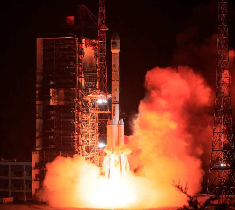
Long March 3B Launch Vehicle
In addition, the service capability of Beidou-3 has been expanded 10 times compared with that of Beidou-2, and more people can enjoy the universal service of Beidou navigation system in the fields of communication, electric power, finance, mapping and transportation, fishery, agriculture and forestry.
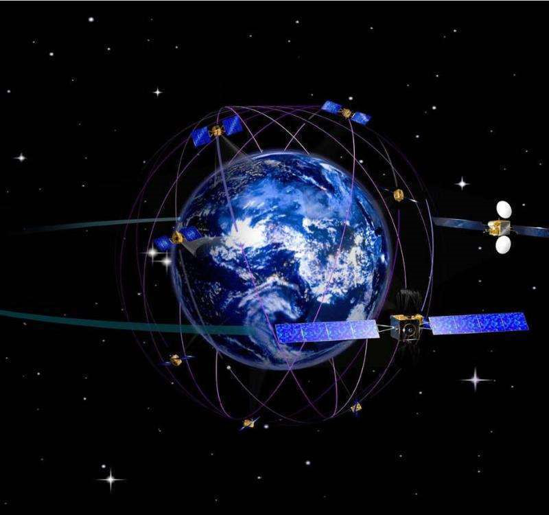
BeiDou system simulation diagram
BeiDou satellite navigation system construction and development to application promotion and industrial development as the goal, not only to build the system, but also to use the system to emphasize the quality, so follow follow the following construction principles:
1, openness. The construction, development and application of BeiDou satellite navigation system will be open to the whole world to provide high-quality free services for global users, actively carry out extensive and in-depth exchanges and cooperation with countries around the world, promote compatibility and interoperability among satellite navigation systems, and promote the development of satellite navigation technology and industry.
2. Autonomy. China will independently build and operate the BeiDou satellite navigation system, which can independently provide services for global users.

Beidou satellite picture
In our life, it is not difficult to find, we have a cell phone or car on the mainstream positioning system is basically GPS rarely found our BeiDou system, it is not difficult to explain, the United States GPS is widely used, the popularity of the large amount has won a broad market. But I believe that in the near future our Beidou system will break this deadlock, and stand on top of the world.