Introduction to GPS positioning systems
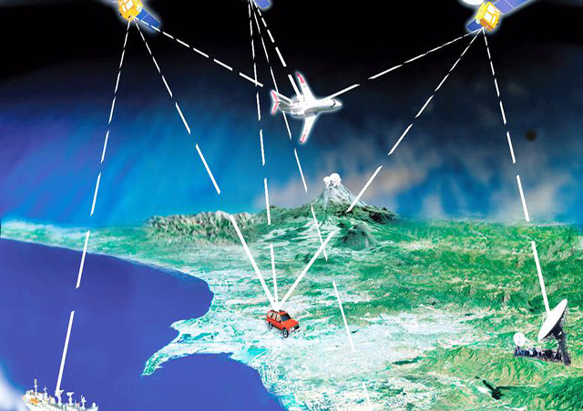
The Global Positioning System (GPS) is a technology that combines the development of satellites and communications, utilizing navigation satellites for time and distance measurement. The Global Positioning System (GPS) was developed by the United States in the 1970s, and was fully completed in 1994 at a cost of 30 billion dollars and more than 20 years. It is a new generation of satellite navigation and positioning system with all-round real-time three-dimensional navigation and positioning capability on land, sea and air. After nearly ten years of use in China's surveying and mapping departments, the global positioning system with all-weather, high-precision, automation, high efficiency and other characteristics, successfully applied to geodesy, engineering surveys, aerial photography, navigation and control of means of delivery, crustal motion measurement, engineering deformation measurements, resource surveys, geodynamics and other disciplines, achieved good economic and social benefits.
Existing satellite navigation and positioning systems include the Global Positioning System (GPS) of the United States and the Globle Naviga2tion Satellite System (GLONASS) of Russia, as well as China's Compass and Europe's Galileo.